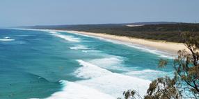
Implementation Plan adopted for Amity Point erosion management
Explore Councils by state

Redland City Council has adopted an Implementation Plan to assist Council and property owners manage erosion along the Amity Point coastline on North Stradbroke Island.
Under Council’s Coastal Adaptation Strategy, Amity Point has been identified as a high-priority locality and has been the focus of Council-led Shoreline Erosion Management Planning (SEMP) since 2015, which sets out steps for property owners to protect their properties.
Redland City Mayor Karen Williams said the southerly migration of the waterway between North Stradbroke and Moreton Island, has caused complex erosion impacts and resulted in decades of informal efforts to prevent property loss.
‘This Implementation Plan is a historic step in addressing these complex erosion issues.
“The plan outlines future works along the three distinct sections or ‘reaches’ of the coastline and agreement on property owner responsibilities, including Council.
“Importantly the plan includes recognition of the effective role the placement of rocks along the foreshore plays against erosion, particularly in the central reach.
“The recognition of this rock structure (known as a flow slide barrier) is a crucial element in the ability of property owners to plan for works to defend their properties.
“Council will assist landowners by applying for a high-level preliminary approval of the flow slide barrier so that landowners can proceed with carrying out the work required to protect their properties.”
Councillor for Division 2, Cr Peter Mitchell said the implementation plan supported landowners in ensuring they have the necessary development permits and approvals to carry out ongoing maintenance work on the section of flow slide barrier protecting their property.
“This implementation plan and the erosion management plan it supports have been developed in close consultation with the residents it is designed to support,” Cr Mitchell said.
“It outlines how residents can secure the permits they need to protect their properties, as well as explaining Council’s role in managing areas that protect local roads and parks.
“Future works will also include ongoing beach surveys and coastal process studies.
“The SEMP and Implementation Plan have also been developed in consultation with other stakeholders, including Quandamooka Yoolooburrabee Aboriginal Corporation, State Government agencies and the project’s Community Reference Group.”
For more information visit yoursay.redland.qld.gov.au/amity-point-shoreline-erosion.